Forest loss is a worldwide issue, with estimates of loss of 489 million hectares since 1990 (FAO 2025). In this context, Paraguay is around the countries with larger net loss in this period, with dramatic loss numbers in recent years (FAO, 2025, Huang et al. 2007). The Paraguayan forest is composed by the Atlantic Forest ecoregion, the Cerrado ecoregion, and the Gran Chaco ecoregion. Amongst these, the Atlantic Forest is the most affected by deforestation, with its territory reduced by 75%. Because of this, maintenance and monitoring of existing protected areas is key to support the remaining biodiversity of the region and the ecosystemic services in the area. The Mbaracayu reserve is the largest and best preserved reserve in the region, with over 90% of its territory representing the Atlantic Forest ecoregion. Among the greatest threats of this reserve is illegal logging, which has only increased in recent times, fostered by illicit marihuana plantations that are planted in the edges of the reserve (Mongabay, 2020).
The objectives of this project are:
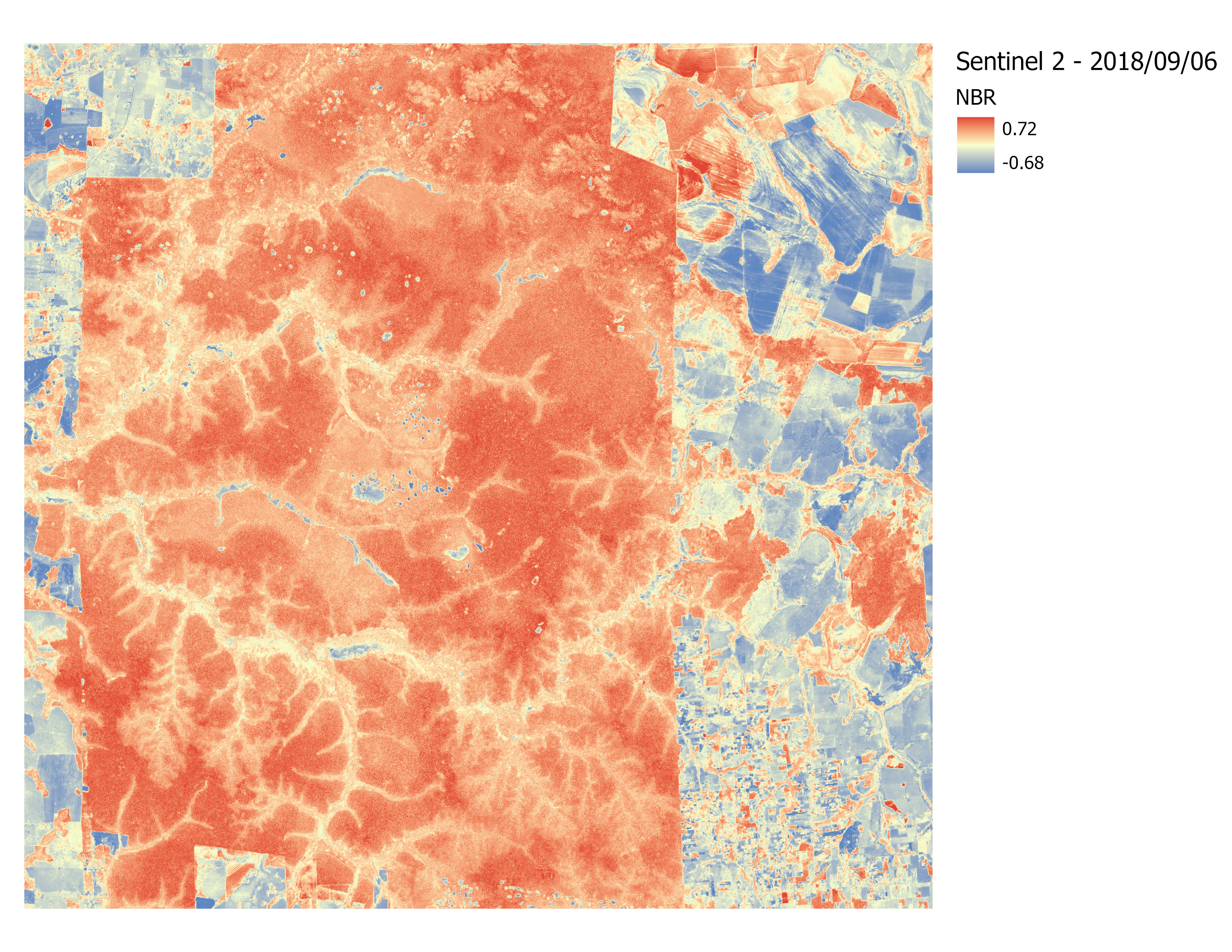
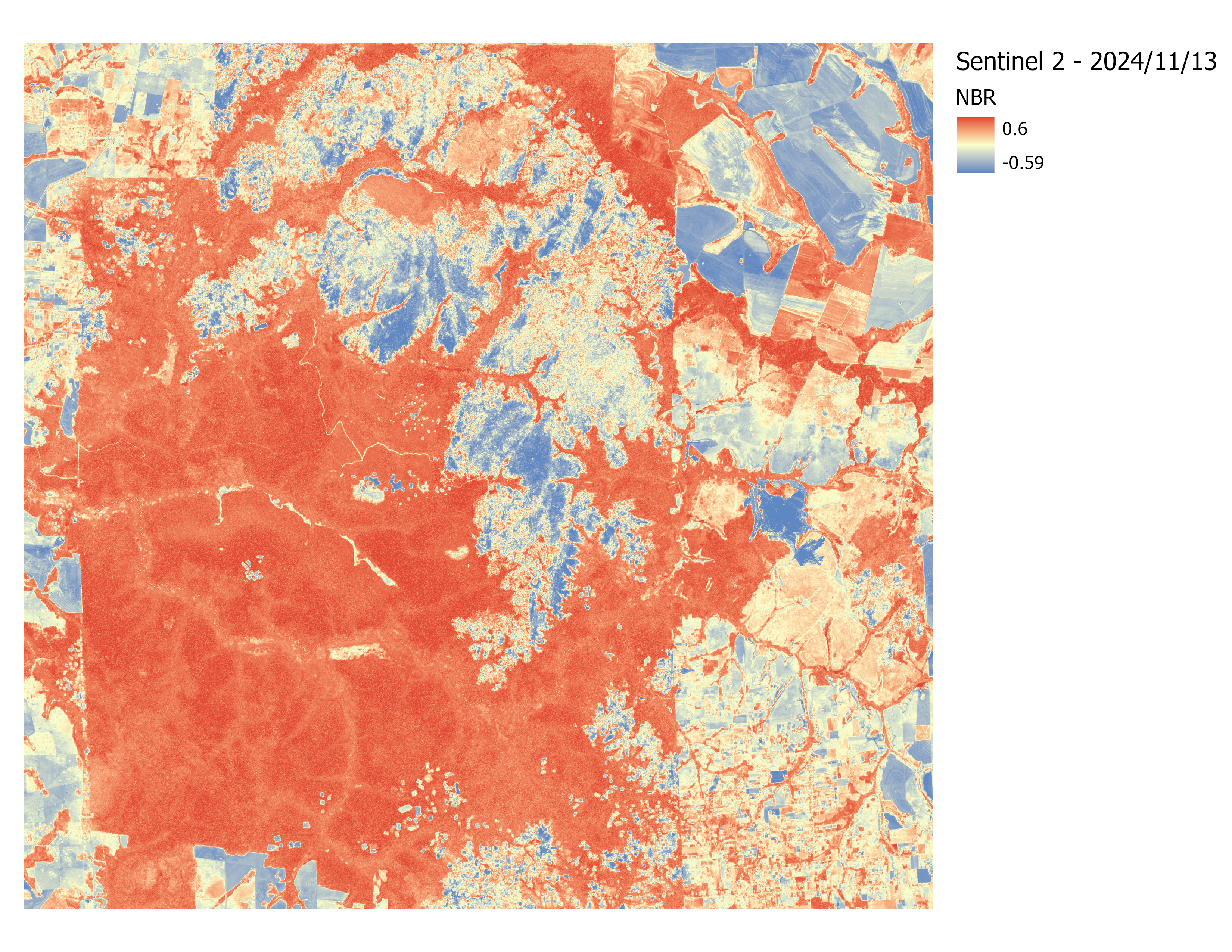
The two periods to consider were 2018 and 2024. The images were classified using IsoData Unsupervised Classification. This method helped with the difficulty of differentiating between bare soil and burned areas, which difficulted a supervised classification approach.
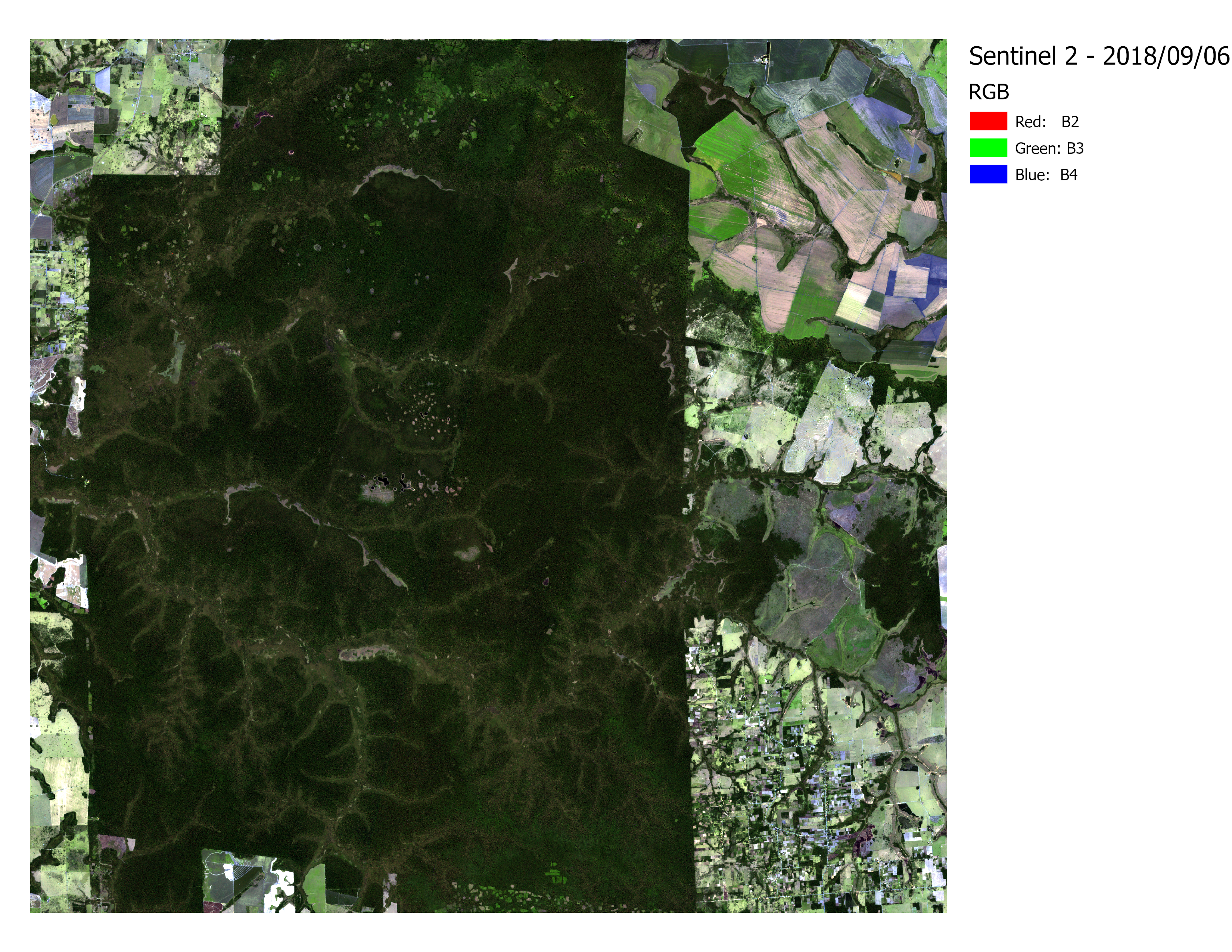
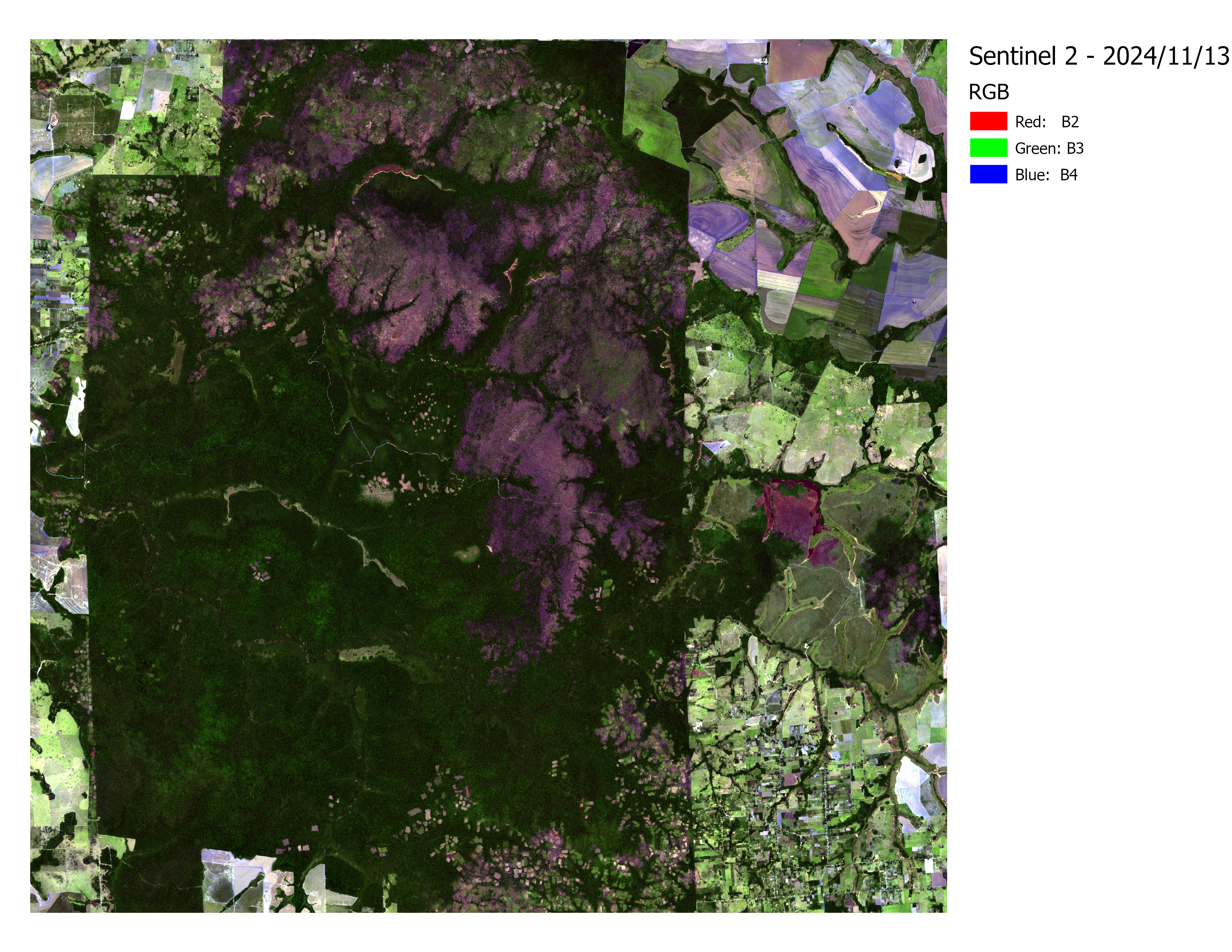
To aid in classification, NIR, NDVI, and RGB bands were used for analysis. Both images were obtained from Google Earth Engine and are provided by the Sentinel S2A sensor:
| September 06, 2018 | November 13, 2024 |
|---|---|
|
|
|
|
|
|
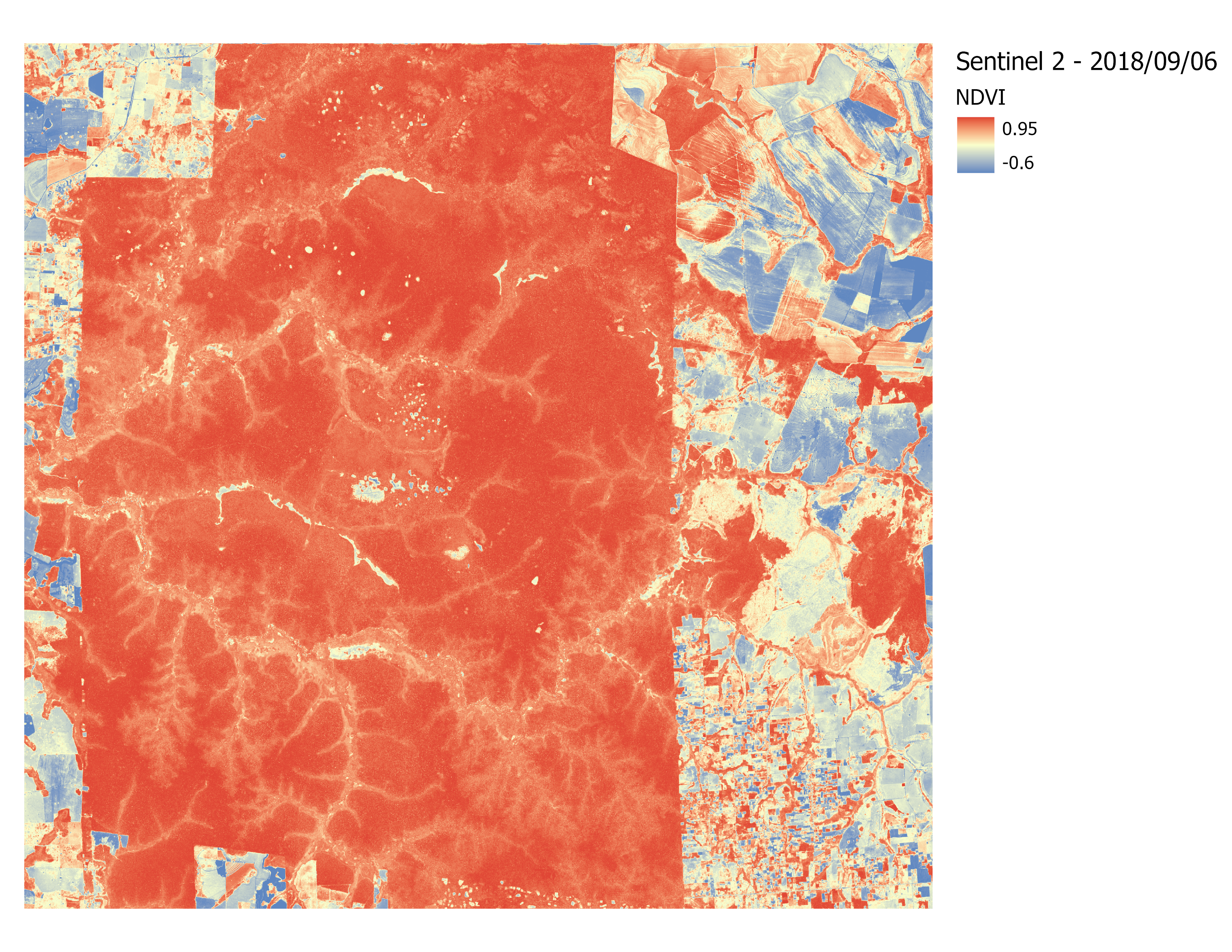
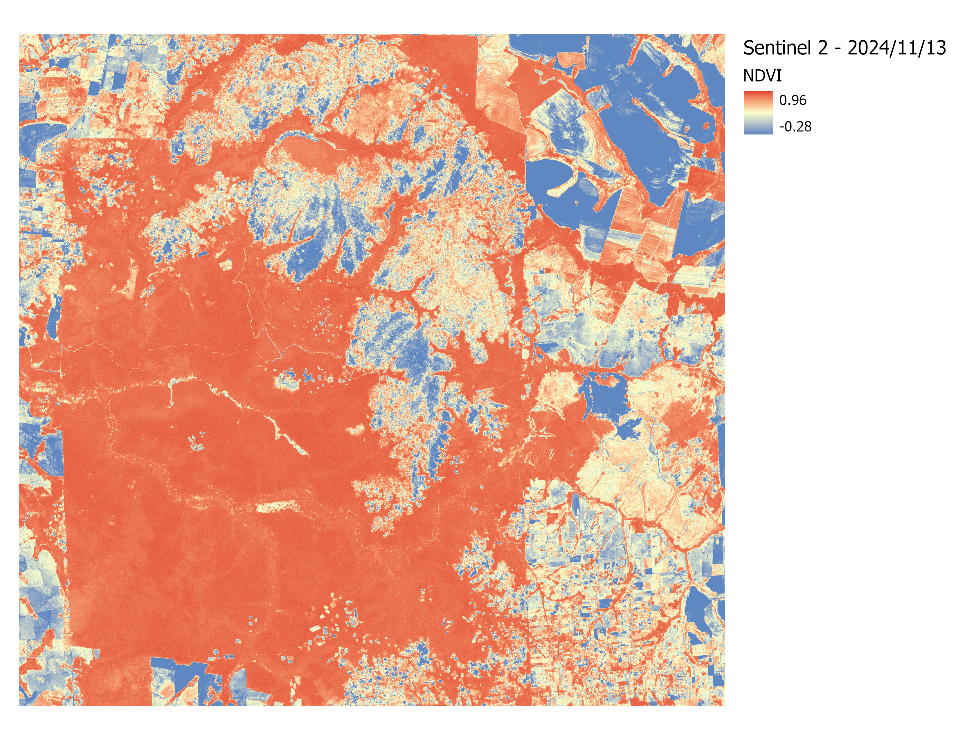
The NDVI and NBR bands helped to determine ground truth, given the lack of high quality imagery to contrast with the obtained Sentinel data.
The two indexes were calculated with the following formulas:
NDVI = (NIR - Red) / (NIR + Red) = (Band 8 - Band 4) / (Band 8 + Band 4)
NBR = (NIR - SWIR) / (NIR + SWIR) = (Band 8 - Band 12) / (Band 8 + Band 12)
| 2018 Classification | 2024 Classification |
|---|---|
 |
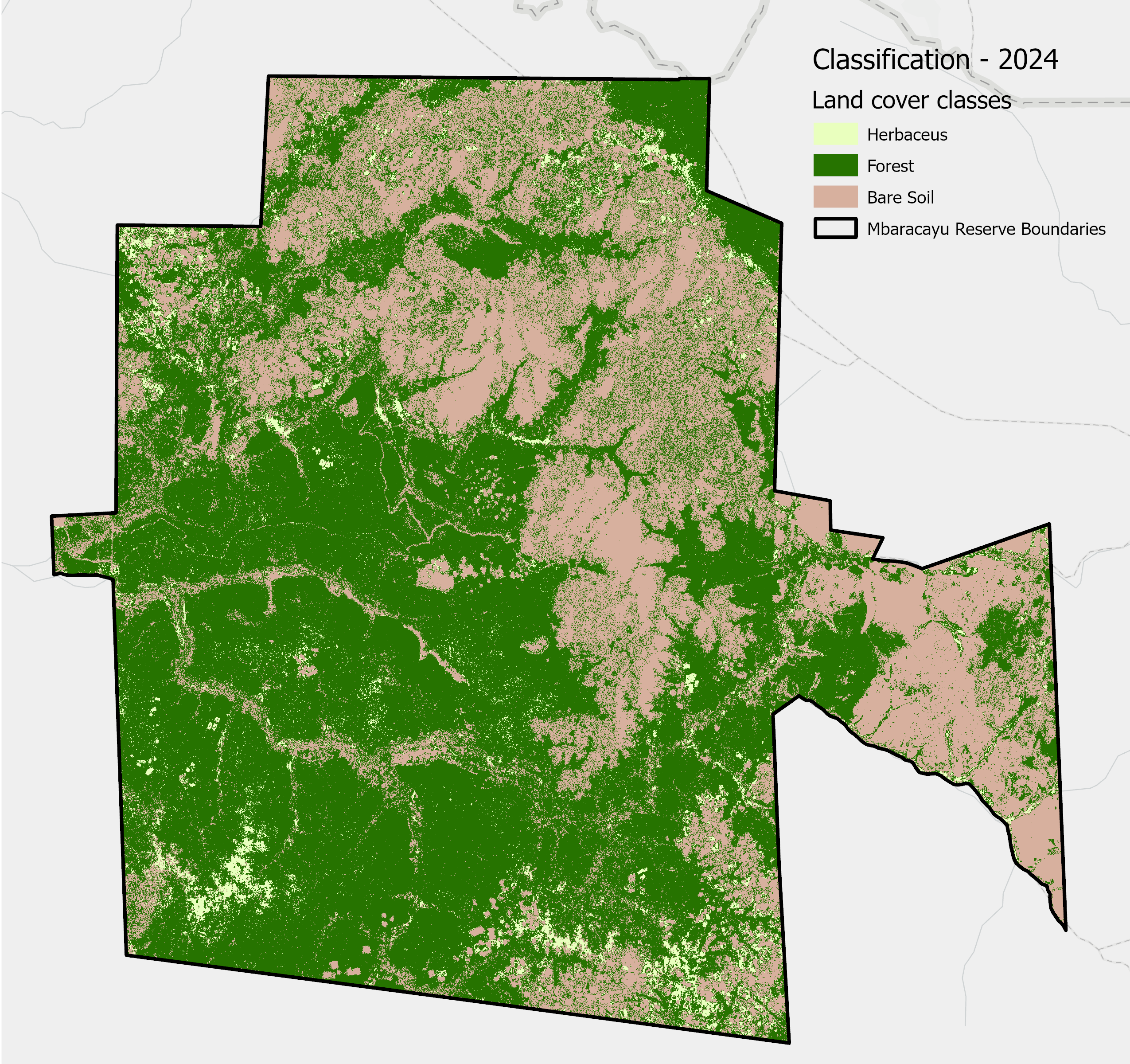 |
This section summarizes the statistical assessment of classification accuracy for the 2018 and 2024 rasters, using the standard metrics of Overall Accuracy (OA) and the Kappa Coefficient (κ̂). A total of N = 50 ground truth points were used for 2018 and 2024, and N = 56 points for 2025.
| Year | Overall Accuracy (OA) | Kappa Coefficient (κ^) |
|---|---|---|
| 2018 | 84.0% | 0.752 |
| 2024 | 82.0% | 0.660 |
In 2024, due to the disturbance introduced by the burned areas, the accuracy of the classification decreased.
Land cover change was calculated using the Change Detection tool in ArcGIS Pro. The analysis focused in category change, particularly in forest change to other cover type.
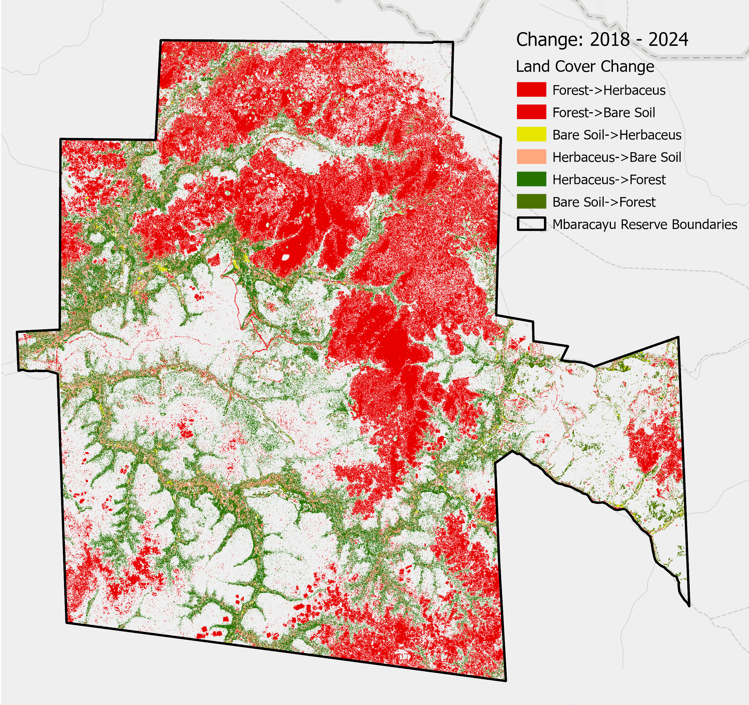
Considering the resolution of the image, the forest loss and gain was estimated.
| Change type | Area in hectares |
|---|---|
| Herbaceus->Forest | 8209.07 |
| Herbaceus->Bare Soil | 2440.67 |
| Forest->Herbaceus | 1912.03 |
| Forest->Bare Soil | 17183.76 |
| Bare Soil->Herbaceus | 219.75 |
| Bare Soil->Forest | 1010.59 |
| Other | 2710.58 |
| No Change | 38016.86 |
The total forest loss then is 19,075.79 hectares. Most of the forest changed to bare soil, this is in part due to the forest fires of 2024 and also by illegal logging in the reserve. On the other hand, 9219.66 hectares of forest was gained in this period.
The degree of disturbance in the Mbaracayu Reserve is confirmed through the analysis. Although the main driver of the disturbance is not illegal logging but rather a wildfire event, the pattern of deforestation along the edges of the reserve is visible. The analysis helped estimate the amount of disturbance, but further analysis is necessary to ensure the results are correct.